Tap water for a readout
Tap any open water for its position and readings, including clouds and time warnings.
What it shows
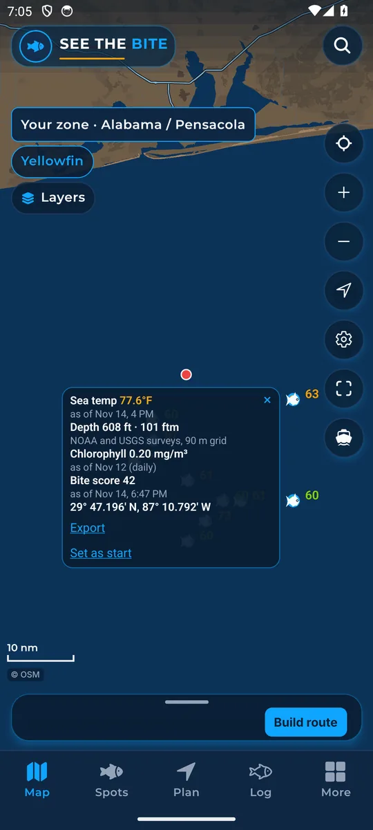
Tap empty water and a small card lists the readings at that spot: sea temperature, depth, chlorophyll (water color) and the bite score, each with its own time. A line under the top bar shows the position in degrees and minutes, the latitude and longitude style most boat plotters use.
How to find it
- Tap any empty water on the chart. That is it.
How to use it
- Read the numbers on the card. Each one has its own as-of time, so you know how fresh it is.
- If a satellite could not see that spot because of clouds, the card says cloud covered instead of guessing.
- If a reading has no timestamp, the card says time unknown.
- Dragging the map does not open the card, so you can pan freely.
- From the card you can tap Export to send that one point, or Set as start.
In the app tour
Tour step 2 of 67 · Map · Tap water
Tap empty water. A degrees-and-minutes line shows under the top bar, and a small card lists the readings there. When clouds block a reading, the card can show cloud covered. Without a timestamp, it says time unknown. Dragging does not open the card.
See this step in the full tutorial →
Related
Every layer is included
One subscription opens every layer and feature. Founders get the first year for $80. See ordering and prices or give a year as a gift.
See The Bite is coming to the App Store and Google Play. The store links are not live yet.