
Loop Current & eddies
Draws the edge of the Loop Current and the rings of warm and cold eddies.
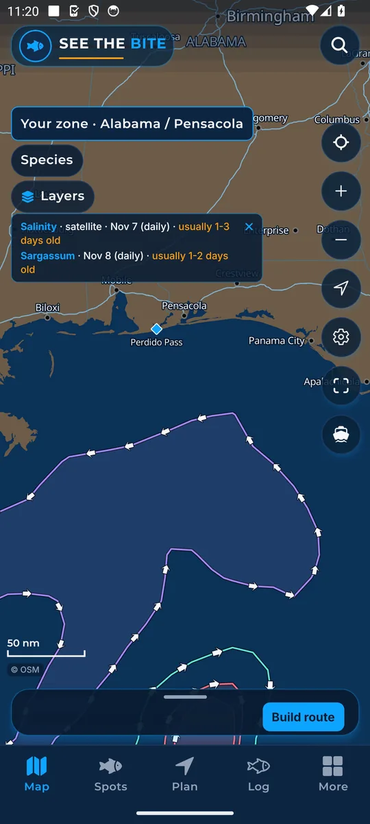
What it shows
The Loop Current is a strong, warm current that flows into the Gulf from the south, loops around, and leaves past Florida. This layer draws its edge (the front) and the rings of eddies that spin off it: warm and cold spinning water.
Where the data comes from
NOAA CoastWatch daily blended surface-current analysis. Check the date beside the layer.
How to turn it on
- Tap Layers, then the Loop Current & eddies checkbox. It turns on only itself.
- Sea height is its own row.
How to use it
- Look along an edge for bait and temperature changes.
- Zoom out to see where the front and the rings sit compared with your port.
In the app tour
Tour step 10 of 67 · Layers · Loop Current & eddies
Loop Current & eddies draws the front and the eddy rings. Tap the checkbox. It turns on only itself. Sea height is its own row.
See this step in the full tutorial →
Related
Every layer is included
One subscription opens every layer and feature. Founders get the first year for $80. See ordering and prices or give a year as a gift.
See The Bite is coming to the App Store and Google Play. The store links are not live yet.