
Detailed bottom (shaded relief)
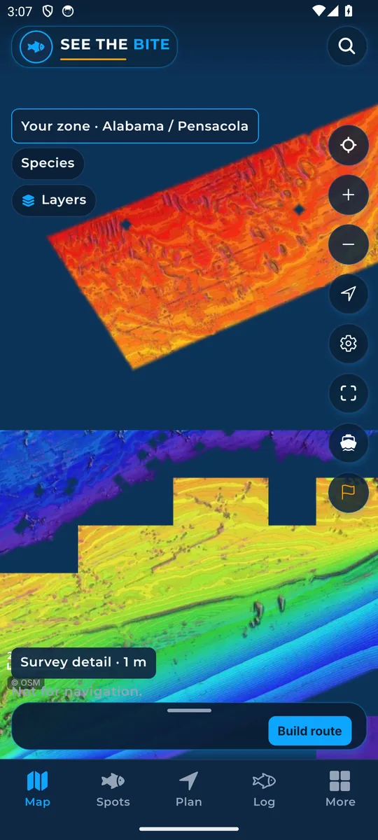
Shaded relief shows ridges, holes and slopes on the sea floor where surveys cover it.
What it shows
Shading shows the sea floor shape: ridges, holes and slopes. Detail only appears where surveys cover it. Standard bottom fills the areas without detail.
Where the data comes from
NOAA hydrographic surveys and coastal grids, USGS CoNED, and BOEM’s deepwater grid. Each source reflects its own survey date.
How to turn it on
- In More, find Bottom detail. Simple is the chart.
- Tap Detailed, when this phone has it, for shaded relief.
- Tap Download detail for this trip to fetch that relief.
- In More layers there is also a Detailed bottom switch.
How to use it
- Find small changes in the bottom near good water.
- Zoom in. The chart tells you when to zoom in for survey detail, or when there is no survey detail in that spot.
In the app tour
Tour step 57 of 67 · More (settings) · Bottom detail
Simple is the chart. Tap Detailed, when this phone has it, for shaded relief. Tap Download detail for this trip to fetch that relief.
See this step in the full tutorial →
Related
Every layer is included
One subscription opens every layer and feature. Founders get the first year for $80. See ordering and prices or give a year as a gift.
See The Bite is coming to the App Store and Google Play. The store links are not live yet.